Introduction | Towns & Villages | Mountains | Landscapes | Buildings | Hiking | Plants & Animals | Photos
Geographic Situation
Introduction - Haute Loire in France | Haute Loire | The Velay, the Meygal Massif and Saint-Julien-Chaupteil | Other Regions
On this page I describe where our holiday area "atour le Meygal" is located in France.
Introduction - Haute Loire in France
Our French holiday region is located in the Haute Loire département (43), which is part of the Auvergne region. The following map shows where the département is located within France:
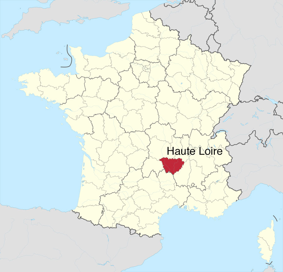
Map: Haute Loire in France (Source: Wikipedia, adapted)
Haute Loire
As stated above, we spend our holidays in the département of Haute Loire (43), which is part of the region "Auvergne." The département consists mainly of the former landscape "Velay" (see below).
Sometimes, we leave the département in the direction of Ardeche (at the Mezenc mountain) or in the direction of Allier. Even though Haute Loire belongs to the "Auvergene," and the landscape is dominated by many former volcanoes, it has little to do with what is commonly understood as "Auvergne" and the perception of which is shaped by the large volcanoes of the Cantal and Puy de Dome regions. The volcanoes in Haute Loire are smaller and are often called "Sucs," at least in the area around Saint-Julien-Chapteuil and Yssingeaux.
The name "Haute Loire" indicates that the river Loire is present deep in the south of France as well. Actually, it starts here. However, it originates slightly outside the département at the Gerbier de Jonc in the département of Ardeche. It then forms impressive gorges in the department of Haute Loire (gorges de la Loire) and disappears northwards in the west of Saint Etienne. While the Loire cuts through the département from south to north approximately in the middle (in the east, the tributary Lignon is present), the west of the department is crossed by the river Allier.
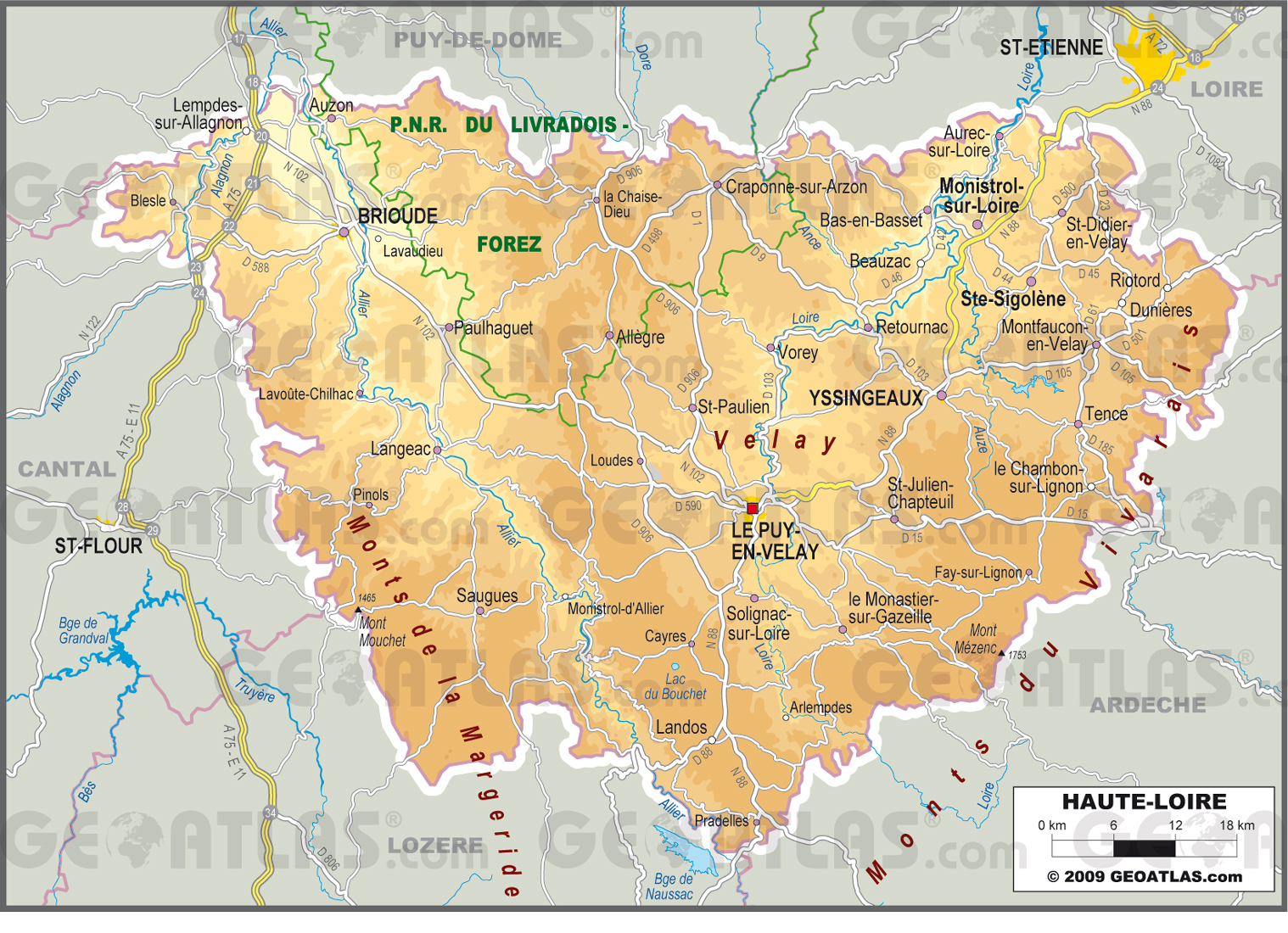
Map: The département Haute Loire (source: Geoatlas.com, © Copyright GEOATLAS.com, downloaded for free)
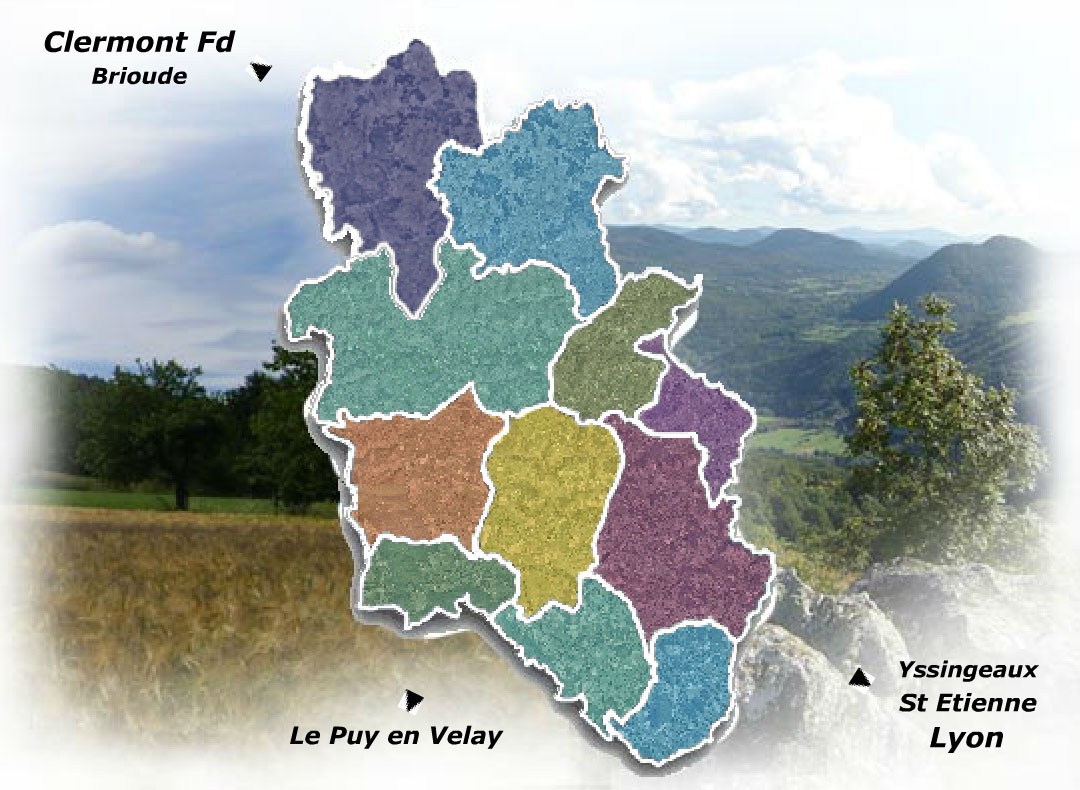
Le Puy, also known as Le Puy-en-Velay, is the capital of the département Haute Loire. It is a city of about 40,000 inhabitants, a place of pilgrimage, a transit point for the Way of St. James and an important regional commercial, administrative, and cultural centre. The next two largest cities in the département are Brioude (nearly 7,000 inhabitants) in the west and Yssingeaux (just over 7,000 inhabitants) in the east. All three cities are capitals of arrondissements of the same names. For us, however, Saint-Julien-Chapteuil and Yssingeaux are the most important cities in the département. The former is the nearest town and thus, a shopping and market place for us, the latter is our point of contact, whenever the shopping possibilities of Saint-Julien-Chapteuil should not suffice. The following map shows the breakdown of the département into arrondissements and probably into landscapes (at least, not in cantons...):
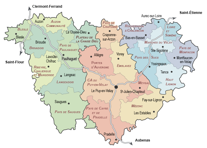
Map: Breakdown of the département Haute Loire into arrondissements and probably landscapes (source: Culture43.fr)
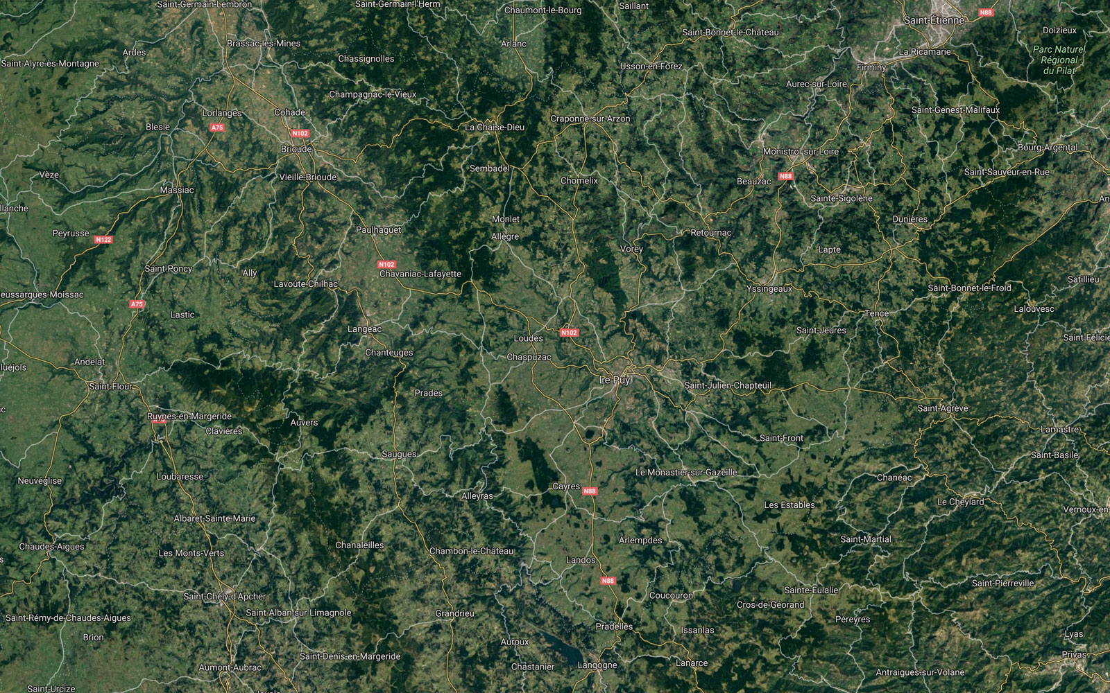
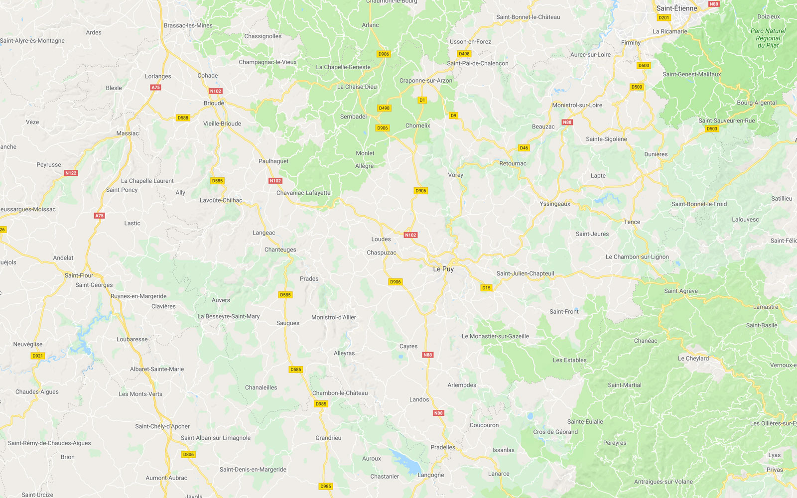
Finally, two views of Haute Loire using Google maps:
The Velay, the Meygal Massif and Saint-Julien-Chapteuil
The Velay is the central landscape in Haute Loire, with Le Puy or Le Puy-en-Velay as the centre. In the German-spaeking Wikipedia I found the following about the Velay:
- The Velay is a landscape in the French Massif Central. It has long been part of the Languedoc, and since the French Revolution it has been the main part of the département Haute-Loire.
- The Velay is located in the south-east of the Massif Central between the valley of the Allier in the west and the hills on the west side of the Rhone. It is a low mountain range with the highest elevation of the Mont Mézenc at 1753 metres.
- The Velay extends around the Massif du Meygal, which is the centre of the
landscape:
- In the east and northeast is the granite plateau of Tence
- in the south the basalt plateau of the Massif du Mézenc
- to the west and southwest, the basin of Le Puy-en-Velay and the Velay volcanic plateau
- in the north the granite plateau of Craponne-sur-Arzon.
- The terrain is interrupted by deep valleys, especially the ones of the Loire and the Lignon du Velay.
The Meygal Massif and Saint-Julien-Chapteuil
Saint-Julien-Chapteuil and the Meygal massif with villages on the western slope form a small closed world for themselves, and as already mentioned, the centre of the Velays. This area is the central point of contact during our holidays, as our campsites were and are located near Saint-Julien-Chapteuil. From both places you can already undertake beautiful walks without having to drive. But most of the time we drive to a certain destination to do a hike.
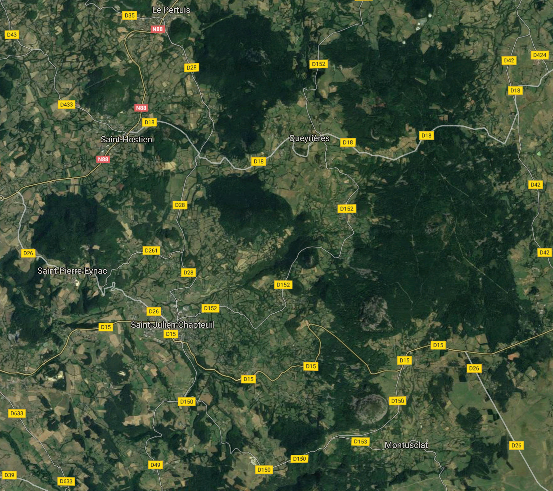
Map: Saint-Julien-Chapteuil and Meygal massif
In winter, the Meygal massif is a popular winter sports area for cross-country skiing.
Other Regions
Pays des Sucs
The Pays des Sucs has the city of Yssingeaux (7000 inhabitants) as its centre and contains perhaps the largest number of small volcanoes called "Suc".
Note: On page Les sucs, ces volcans endormis, you will find some information about these dormant volcanoes (in French).
Emblavez
The Emblavez is located north of the N88 (and Saint-Julien-Chapteuil). One of the larger towns we touch again and again is Rosières. What the Emblavez is exactly comprised of, I was not to determine exactly, but today it is a group of 11 communities. One of the main attractions is the castle of Lavoûte-Polignac above the Loire. Map of the Emblavez today:
Das Emblavez liegt nördlich der N88 (und von Saint-Julien-Chapteuil). Einer der größeren Orte, den wir auch immer wieder berühren, ist Rosières. Was das Emblavez genau ist, konnte ich nicht genau feststellen, heute ist es ein Verbund aus 11 Gemeinden. Eine der Hauptsehenswürdigkeiten ist das Schloss von Lavoûte-Polignac über der Loire. Karte des Emblavez heute:
Map: Das Emblave (Quelle: Comunauté de communes de l'Emblavez)
Mezenc
Mont Mezenc (1753 m) and its partner Mont d' Alambre (1691 m) are the highest mountains in Haute Loire. Both mountains are easy to climb and are situated in the east on the border with the département of Ardeche, where the mountains continue, for example, to the Gerbier de Jonc, where the Loire originates. In good weather, you can see the chain of the Alps, but not only from the two mountains, but also from some other places.
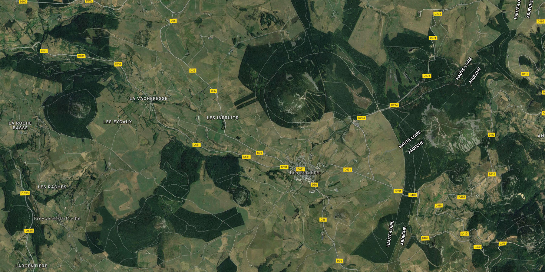
Map: The Mezenc massif at the département border to Ardeche (Mont l'Alhambre in the center)
Les Estables is the most important tourist resort in this area; it also offers alpine winter sports (ski lifts at Mont l' Alambre).
Allier Valley
To the west of the département, the Allier winds its way from south to north, forming loops and gorges, with beautiful villages, castles, and abbeys. However, we do not travel this area often because this is always connected with a longer car ride.
More about this later...
Links
- Haute Loire - Le Departement: www.hauteloire.fr
- Haute Loire (Wikipedia): de.wikipedia.org/wiki/Département_Haute-Loire
- Velay (Wikipedia): de.wikipedia.org/wiki/Velay, en.wikipedia.org/wiki/Velay
- Comunauté de communes de l'Emblavez: www.cc-emblavez.fr
- Yssingeaux: www.yssingeaux.fr
- Office de Tourisme Des Sucs aux bords de Loire: www.office-de-tourisme-des-sucs-aux-bords-de-loire.fr
- Les sucs, ces volcans endormis: www.office-de-tourisme-des-sucs-aux-bords-de-loire.fr/je-decouvre/nature-paysages/les-sucs-ces-volcans-endormis/
- Les Estables: lesestables.unblog.fr
|
made by |
||
| 29.01.2018 |