Introduction | Towns & Villages | Mountains | Landscapes | Buildings | Hiking | Plants & Animals | Photos
Towns and Villages: Araules, Saint-Jeures, Tence
About the Villages | Additional Information | Map | Photo Album | Hiking Tours | Links
This page introduces a couple of communities east of the Meagal massif along the D18 and later the D103: Araules Recharinges, Saint-Jeures, Tence.
About the Villages
When discussing the villages east of the Meagal massif, I follow the D18 from west to east.
Araules Recharinges
Araules at the D18 and the village of Recharinges further south at the D42 form, together with another village, the municipality of Araules Recharinges (621 inhabitants; 1044 m). Araules is a little bigger and known to us for the cheese dairy Gerentes (Laiterie Gerentes), which has not only its factory but also a shop in the village. But there, one rather buys the products in large quantities. And because we rarely come to Araules, we only buy their cheese or butter in the supermarket. We especially like the fresh goat cheese (Cadichèvre). Araules is not far from the Pic du Lizieux mountain, and seen from there, Araules stands out above all for its high grain silos...
The village of Recharinges looks a bit like a stony street village...
Saint-Jeures
Further east on the D18 you will find Saint-Jeures (955 inhabitants, 1,040 m), which has (or had...) a Sunday market. It was, however, a long time ago that we visited it. Saint-Jeures offers an old church, a temple (Protestant church), several Béates, fountains, old washhouses and water troughs. Of course, Saint Jeures also advertises with its proximity to the Pic du Lisieux...
Tence
The small town of Tence (3,290 inhabitants, 850 m) is clearly further east on the Lignon, and while we thought that it would continue to go downhill there over the years, the opposite seems to be the case: Tence is currently (2018ff) attracting attention in the media as an up-and-coming municipality.
According to Wikipedia, there are the following sights in Tence:
- Old town
- Parish church from the 16th century
- Chapel of penitents from the 18th century
- Small Protestant church from the 19th century
- Bridges and wells
Tence used to have a paper mill (papeterie), which had almost 200 workers at the beginning of the 20th century, but closed down in 1926. In World-War II, the Vichy regime used the large, empty buildings to intern German Nazis, but also Jews; most of the latter died later in German extermination camps. At the river Lignon, which had served as water supply for the old paper mill, a large memorial stone was erected in 2005. A smaller stone immediately next to it commemorates the fate of the short-term camp inhabitants in the internment camps of 1939 and 1940 (according to Wikipedia, adapted).
Near Tence, our former camping neighbours bought a half of a house, and we visited them there already.
Mountains
Testavoire (1,436 m), Pic du Lizieux (1,388 m)
Additional Information
Curiosities
- Chapelle de Pènitents (chapel of penitents) in Tence
Facilities
- Laiterie Gérentes with shop in Araules (sale of milk and cheese)
Specialties
- Cross-country skiing in the Meygal massif in winter
Towns and Villages Near-by
- Chambon-sur-Lignon
- Yssingeaux
Road Connections
- The D18 runs from Saint-Hostien to Araules and further on to Saint-Jeures; it which allows access to the Meygal Massif, runs later together with the D103 to Tence, and then further east.
- The D42 runs from north to south from close to Yssingeaux, where it joins the D7, and continues south to Champclause, where it joins the D26 to the south; this road soon joins the D500, which continues to Fay-sur-Lignon.
- Tence is crossed by the D103, which comes from Yssingeaux, goes together with the D18 shortly before Tence, and bends southwards to Chambon-sur-Lignon in Tence.
- From the north the D500 comes, which seems to end in Tence.
- The D185 branches off from the D103 to the south, and its further course near Chambon-sur-Lignon remains unclear to me...
Curiosities in the Environment
- Meygal massif
- Pic du Lisieux
Map
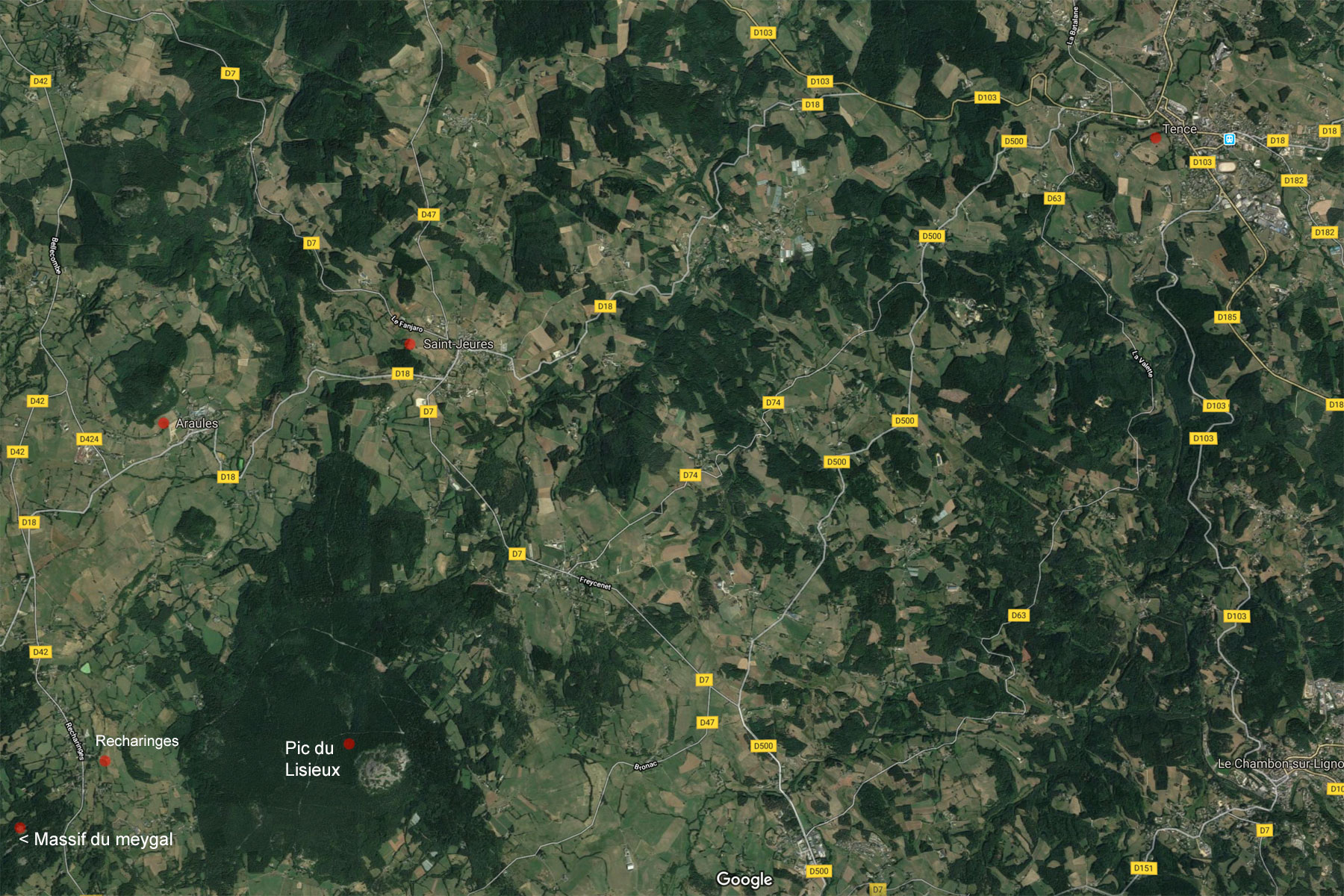
To the east of the Meygal massif, which is no longer on the map, the villages of Araules (Recharinges lies south of the D42) and Saint-Jeures are traversed by the D18. Further east, the D18 meets the D103, which continues towards Tence.
Photo Album
In preparation
Hiking Tours
| Starting Point | Length | Duration | Altitude |
|||||
| Number | Recommended | Alternative | Name | (km) | h:min | min | max | References |
| PR639 | Monbuzat | Sentier de Bonas | 4,4 | 1:30 | 1198 | 1367 | La Haute Loire ... à pied (35) | |
| around the Pic du Lizieux | ||||||||
| Magenta: Older version (Randonées pédestre et VTT au pays des sucs - Yssingeaux) | ||||||||
| Blue (italic number): Older version (Itineraires Pedestres en Haute-Loire) | ||||||||
| Red: New | ||||||||
Details:
- Respirando - Les sentiers de Promenades et Randonnées (PR) Respirando: www.respirando.fr/index.php/apied/les-sentiers-de-petites-randonnees-pr-respirando.html
Links
- Bienvenue au Pays du Meygal (F): www.auvergne-paysdumeygal.com
- Laiterie Gérentes: www.laiterie-gerentes.com
- Laiterie Gérentes (Facebook): de-de.facebook.com/laiteriegerentes
- Saint-Jeures: www.saint-jeures.fr
- Ville de Tence: www.annuaire-mairie.fr/ville-tence.html
- Tence (Wikipedia, in German): de.wikipedia.org/wiki/Tence
- Tence: www.cc-hautlignon.fr/communes/tence/
|
made by |
||
| 19.03.2019 |