Introduction | Towns & Villages | Mountains | Landscapes | Buildings | Hiking | Plants & Animals | Photos
Hiking
Introduction | Information About Hiking Trails "once and now" | How It all Started (for Us) | Now it Gets "Official"! | A few more Tips | Our PR List - Does not Materialize! | Book List | Links
On this page I explain why I do not dedicate a detailed section to our hiking tours in the Haute Loire.
After all, I describe some short hikes (or walks...) and viewpoints on page Short Hikes and Viewpoints.
Introduction
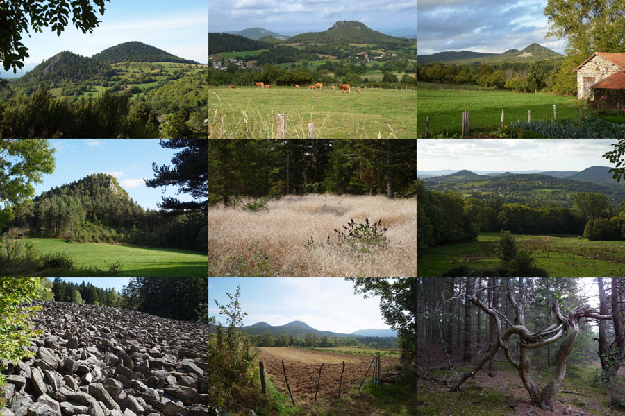
Haute Loire is a great hiking area with many beautiful trails, typically called "Petites Randonnees" (PR). So it made sense for me to include on this website a list of hiking trails that we have hiked in all the years that we have traveled this area. However, I have had to give up this plan in the meantime. On this page, I provide some background information and try to explain why...
Information About Hiking Trails "once and now"
When we discovered the Meygal area for us in the early 1990s, there was little information on hiking tours (PRs = Petites Randonées). Today, you only need to visit the Respirando or Visorando Websites - and perhaps a tourist office to buy one or more of the Topo guides with PRs or other hiking trails. Thus, if you want to, you can skip my further text and move forward straight to the links and the book list...

How It all Started (for Us)
When we stayed overnight for the first time on our "camping a la ferme" in Marcilhac in 1990, we noticed a few notes in the washhouse with walks into the surroundings. Maybe there were also some handwritten or typewritten pages with walks, I cannot remember this anymore. In any case, there was also a map of the surrounding area where you could have a closer look at the area.
When we returned to the campsite in autumn 1992, hiking was, however, not an option for us, because I had my foot bent over. So we took our bicycles with us for the one and only time (I fell with my bike and knocked out my front teeth - I had the teeth provisionally restored in Saint-Julien-Chapteuil for the time being). I believe, however, that at that time we already bought a small folding box with single sheets of paper with PRs (very practical!) in the tourist office of Saint-Julien-Chapteuil. In addition, they had a leaflet with a hike around the mont Rouge, which never made it as a PR.
Since 2001, we visited this area each year, and almost always it was a "hiking" vacation. But the length of our hikes was always limited, because we photographed a lot and often had a picnic. Only between 2005 and 2008, when walking was getting harder and harder for me because of my poor hips, we drove around by car and "explored" the Loire and the Allier valleys.
Now it Gets "Official"!
In 2001 the first Topo-Guide was published, the first one we bought was for the Emblavez, the second one for the Sucs and the Meygal, a book with collected PRs meant to replace the collection of sheets. Since when we actually own Topo-Guides, I don't know any more... This change resulted in the first discrepancies between the "old" PRs and the new ones from respirando. Since we often insisted on doing the hikes in the "old" form, we often ran into problems, sometimes because of misleading signage, sometimes because the yellow markers of the old route had been removed. Incidentally, all trails are marked in yellow, which can also lead to problems at intersections and overlaps...
Before the new Top Guides were released in 2013 and 2014, preliminary sheets were available for some PRs, which you could get for free at the tourist office. And of course, the new tours were not always identical to the old ones... Some PRs seem to have disappeared completely, and, of course, new ones have been added.
A few more Tips
Basically, we always took the liberty to deviate from the PRs, to go only parts of a PR, if it seemed too long for us, and to connect or mix PRs. And since PR's are round trips, we often started them at completely different locations than at the "official" starting points.
Most of the time, we follow the PRs in the "prescribed" direction (we failed miserably in the Cevennes with going the "opposite" direction), but normally the walks are signposted in such a way that you can follow them safely in both directions.
Again and again, however, scouting is also called for, because the tree or stone that carried the marking no longer exists or lies somewhere else... Therefore, it is strongly recommended not only to carry the corresponding Topo guide with you, but also the corresponding map in scale 1:25000 (except for that you know the routes well). In any case, it is rarely possible to avoid intense discussions about the "right path"...
Our PR List - Does not Materialize!
So I had initially created a list of PRs that were relevant to us, and in it I tried to list all the variants that emerged over time (which variant we chose often depended on practical considerations). In the course of time, however, it became clear that such a list would not make sense due to the constant changes in the hiking trails themselves and in the books, and would only lead to endless work. These changes will influence just about everything: Ways, durations, lengths, heights, and sometimes even the PR number. Nobody can keep this up-to-date and "sort that out"! That Is why I decided to do without a larger section about hiking trails (PRs) on this Website, even though I had planned and set up this section at the beginning. I will, where easily possible, refer to corresponding PRs for places, mountains, and other "landmarks", but only by number, and I will hardly give any further details, because these are always changing.
Book List
| Year | Ref. | Book Title | Series | Number of Hinking Tours |
| 2018/6 | P438 | Le Pays des Sucs, de la Loire au Meygal ... à pied (2e éd.) | TopoGuides PR | 26 |
| 2014/3 | D043 | La Haute Loire ... à pied (1re éd.) | TopoGuides PR | 43 |
| 2014/5 | P435 | Le Massif du Mézenc et de la Loire sauvage ... à pied (4e éd.) | TopoGuides PR | 28 |
| 2013/11 | P438 | Le Pays des Sucs, de la Loire au Meygal ... à pied (2e éd.) | TopoGuides PR | 26 |
| 2004/4 | P435 | Le Pay du Mézenc et de la Loire ... à pied (2e éd.) | TOPO-GUIDE PR | 44 |
| 2002/12 | P438 | Le Pays des Sucs et du Meygal ... a pied (1re éd.) | TOPO-GUIDE PR | 23 |
| 2001/7 | P435 | Le Pays du Mézenc ... à pied (1re éd.) | TOPO-GUIDE PR | 23 |
| 2001/3 | P433 | Le Pays de l'Emblavez ... à pied (1re éd.) | TOPO-GUIDE PR | 25 |
Links
- Respirando: www.respirando.fr
- Respirando - A pied: www.respirando.fr/index.php/apied.html
- Respirando - Les sentiers de Promenades et Randonnées (PR) Respirando: www.respirando.fr/index.php/apied/les-sentiers-de-petites-randonnees-pr-respirando.html
- Respirando - Grandes Randonnées en Haute-Loire: www.respirando.fr/index.php/apied/les-sentiers-de-grandes-randonnees-gr.html
- Visorando, Haute Loire: www.visorando.com/randonnee-haute-loire.html
|
made by |
||
| 18.07.2022 |